
Satellite observations of sea surface height indicated that the 2026 event continued to strengthen in early June.
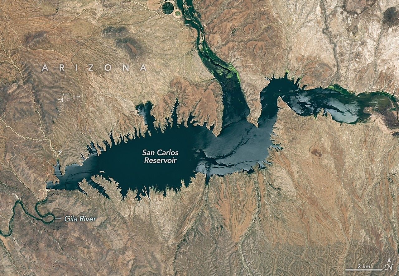
Drought and water releases drained the Arizona reservoir to levels that have led to widespread fish deaths.
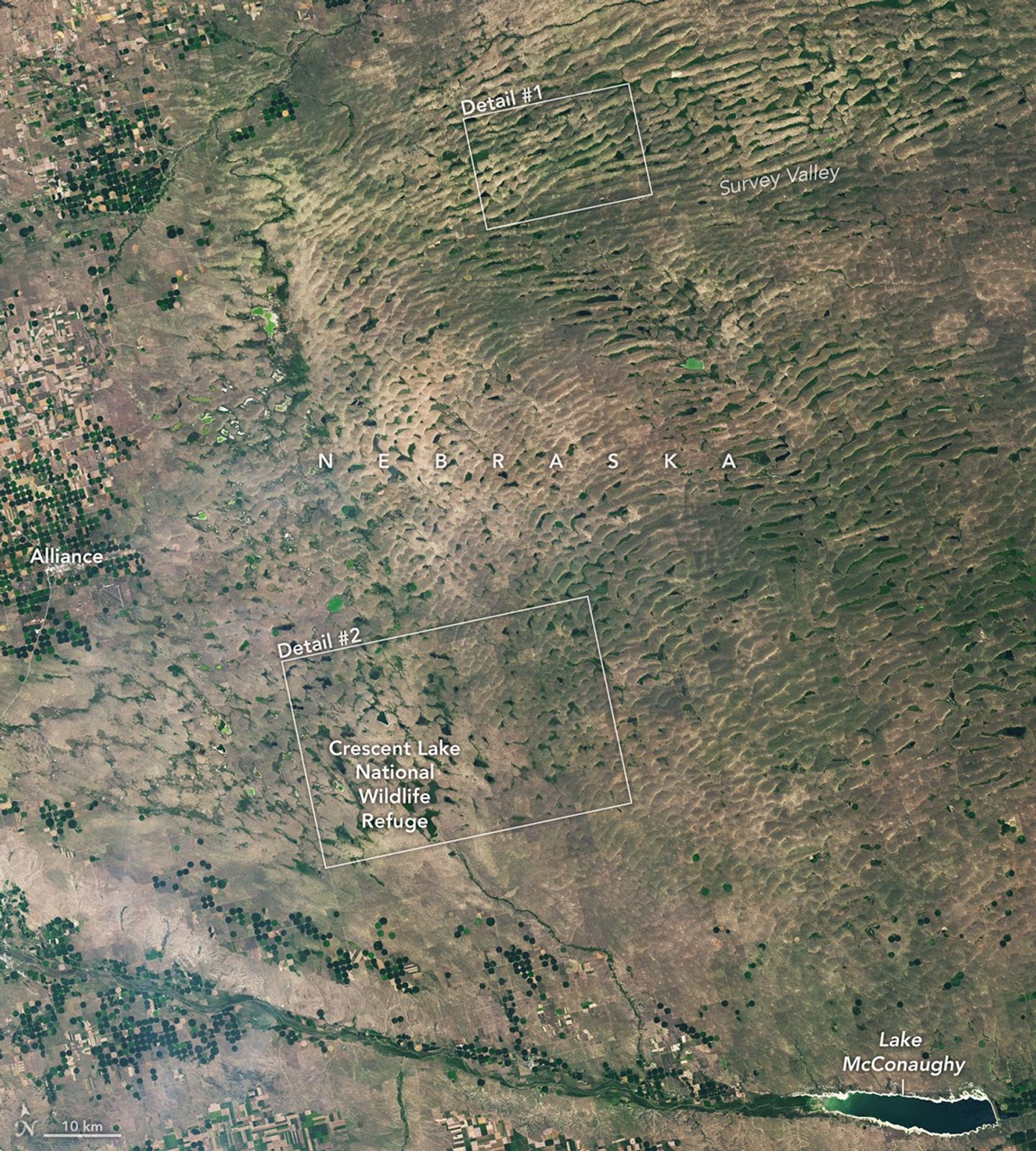
The Nebraska Sandhills—the largest system of sand dunes in the Western Hemisphere—stretch across about one-quarter of the state.

Buoyant volcanic rock fragments from an underwater eruption drifted across the Bismarck Sea and choked island coasts.
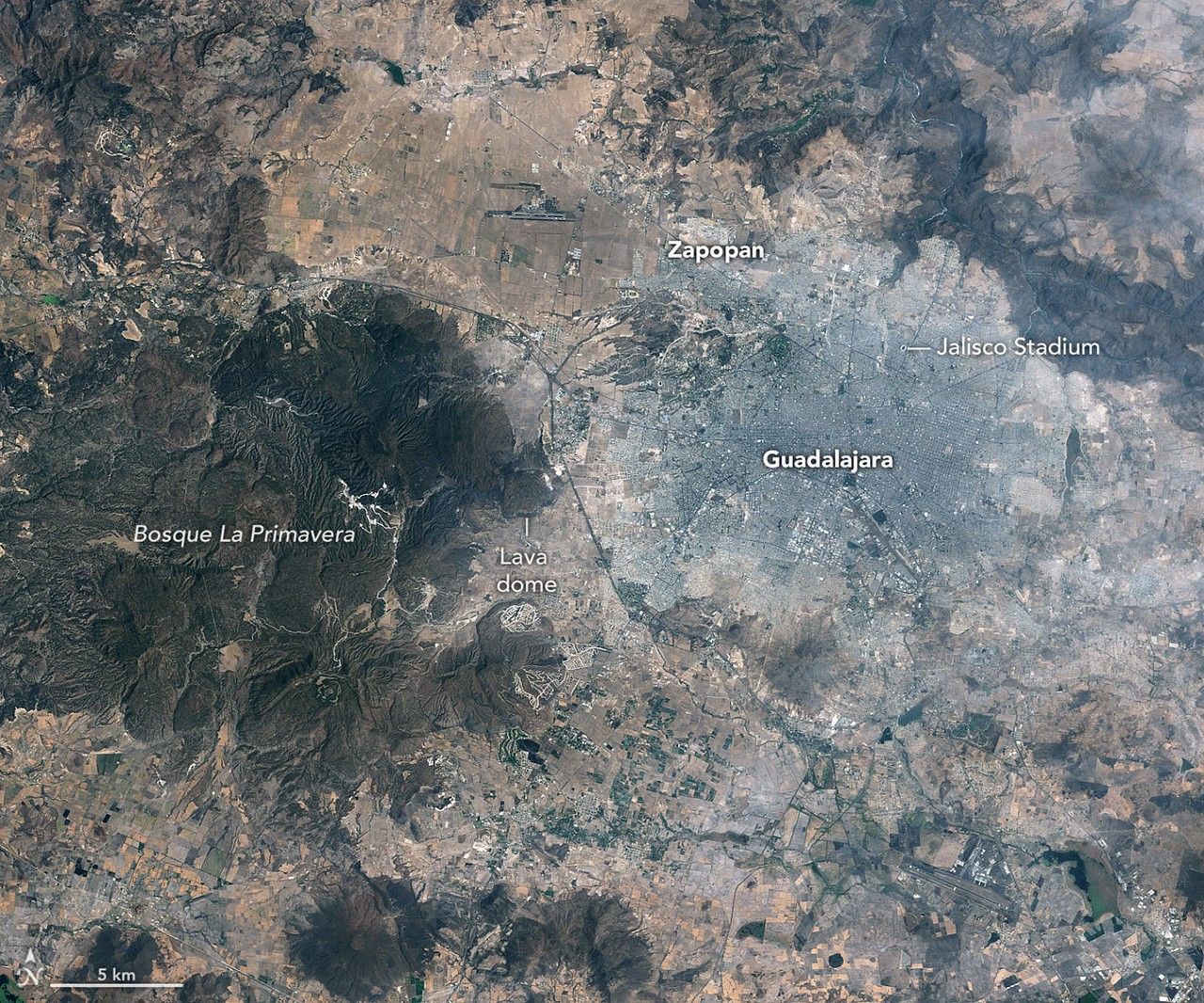
The city’s metro area has pushed westward since it last hosted World Cup matches in 1986, expanding across a landscape shaped by ancient volcanoes.

Ice splintered off the southern Patagonia glacier and drifted across a growing glacial lake.

Your challenge is to tell us the location of the satellite image and why it is interesting.
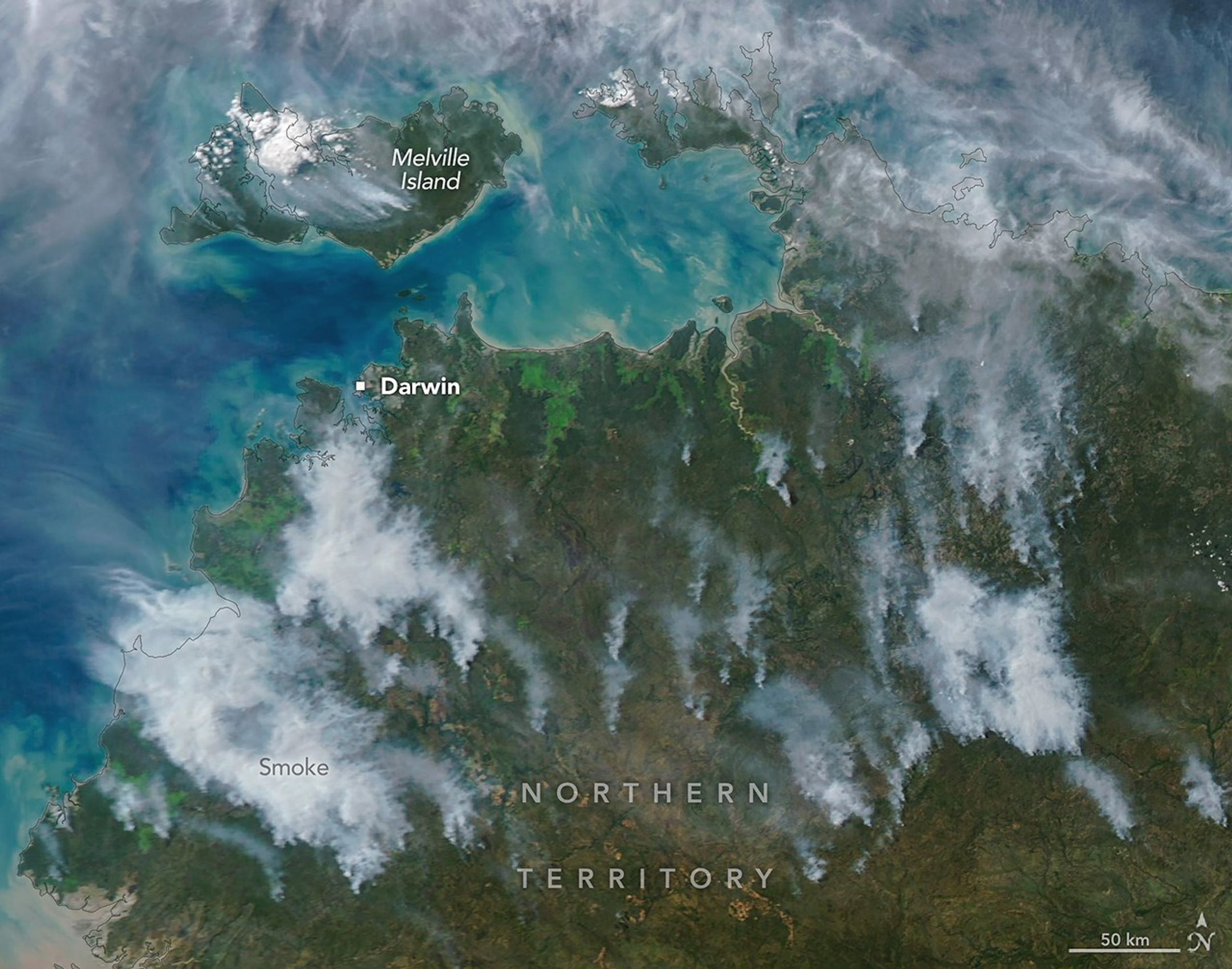
In fire-prone ecosystems in Australia’s Northern Territory, prescribed burns are lit to minimize the severity of fires later in the season.

An astronaut’s photo, taken en route to the Moon, reveals our planet and its place in space in a novel way.

The sprawling storm promised to deliver torrential rain across a wide swath of southern Japan.