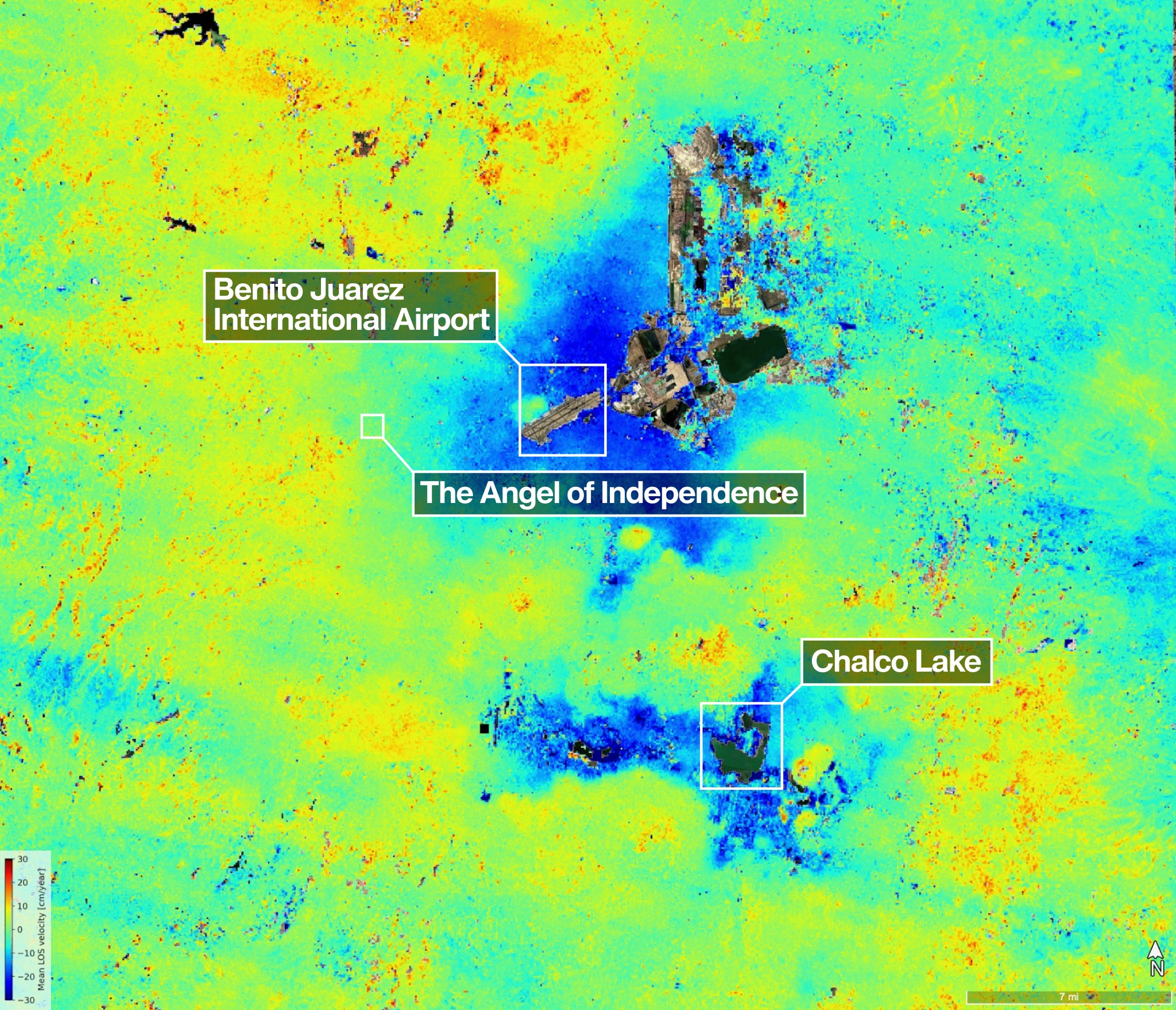
One of the most powerful radar systems ever launched into space has mapped the ground moving beneath one of fastest subsiding capitals in the world: Mexico City. The findings show how quickly and reliably the NISAR (NASA-ISRO Synthetic Aperture Radar) satellite can track real-time changes across Earth’s surface from orbit, unhindered by clouds or vegetation […]

By Earth Resources Observation and Science (EROS) Center For more than 50 years, Landsat has imaged Earth’s land and near-shore surfaces as the satellites descend in midmorning orbit, when daily sunlight is optimal. That’s just what they’ve always done. Currently, Landsat 8 and Landsat 9 circle the globe while also making better use of their ascending paths, […]
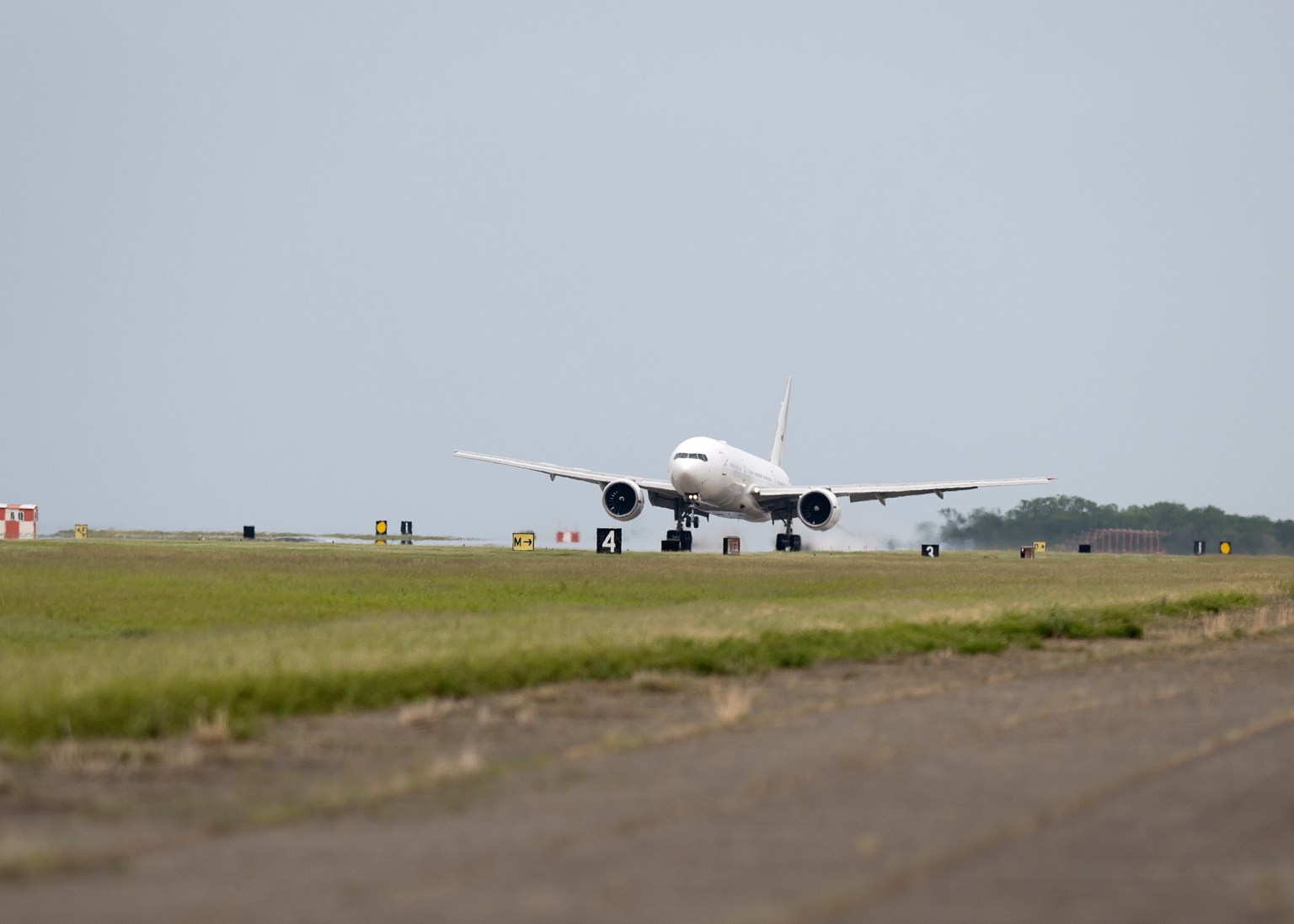
NASA’s Boeing 777 has returned to the agency’s fleet after undergoing heavy structural modifications as it transforms from a giant passenger plane into the agency’s next-generation airborne science laboratory. After a check flight and a three-hour transit from Waco, the aircraft returned to NASA’s Langley Research Center in Hampton, Virginia, on April 22. Since January […]
This Earth Day, we reflect on our home planet and look at Earth from space through history.

This image, released in celebration of Earth Day, shows the terminator – the line between night and day – on Earth. The Artemis II astronauts captured this view on April 2, 2026, during their journey to the Moon. NASA science improves life on Earth every day. The agency provides insights on our home planet that […]

From cameras pressed against spacecraft windows to the most powerful radar ever flown, imaging technology has taken giant leaps since 1968, but the drive to understand our home in the cosmos has remained.
Celebrating Earth Day with an image of Earth captured by NASA’s Artemis 2 mission around the moon.
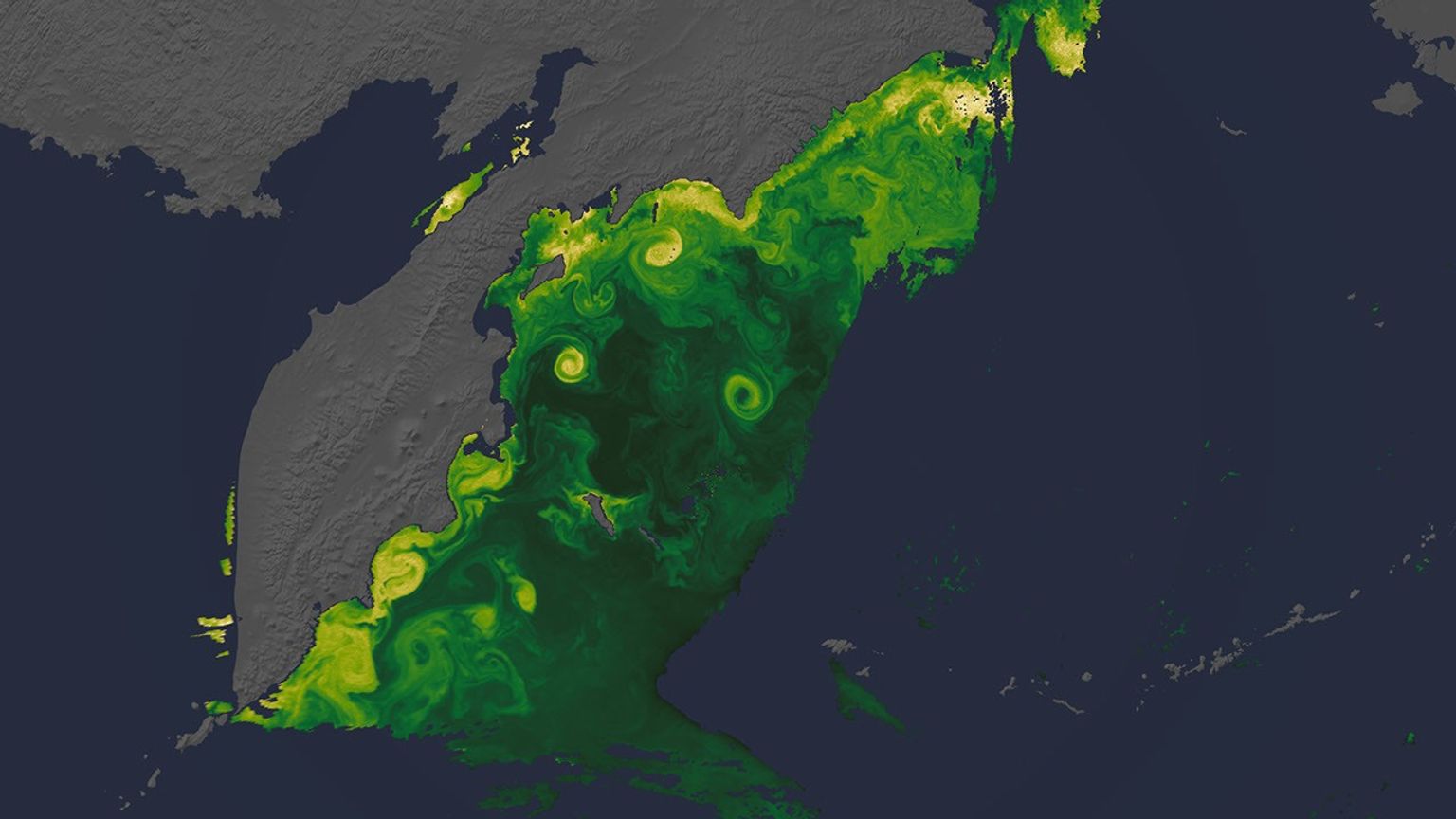
NASA has a fleet of satellites in orbit, gathering data around the clock, to explore unique views of our home planet’s ocean, atmosphere, and land surfaces.

Dr. Alex Goetz, who passed away in 2025, was a member of the Landsat 7 Science Team and a key figure in the history of Landsat science.
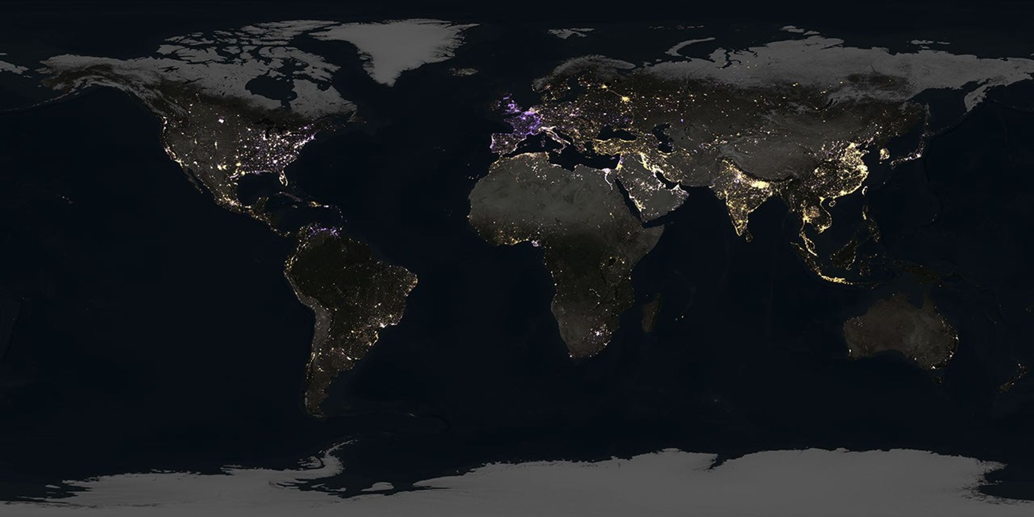
New nighttime maps based on NASA satellite imagery are upending assumptions, revealing a world where artificial brightening and dimming have intensified over the past decade. The findings show intense flaring over major oil and gas fields in the United States, while factors such as rural electrification and energy conservation are changing how billions around the […]